Saturday, 7 April 2012

The Actual Trip: Day 8

Hello from Wick! Well, I did it, I drove round the north coast of Scotland! The weather wasn't great though, and quite foggy in places but still was a lot of fun.
The A832. There was a lot of it.

The day started with a huge diversion. You may recall my comments about the A890 at Stromeferry having been closed for months due to a landslide. Well, they have set up a sort of huge level crossing so that traffic can go along the railway line, but, only at certain times. Not being familiar with the area I wasn't sure I could get there for one of those times, and with the gaps between them being 2 hours I decided to play safe and take my alternate route, which was no longer and still let me do the bit I really wanted to do; i.e. Ullapool to Wick.

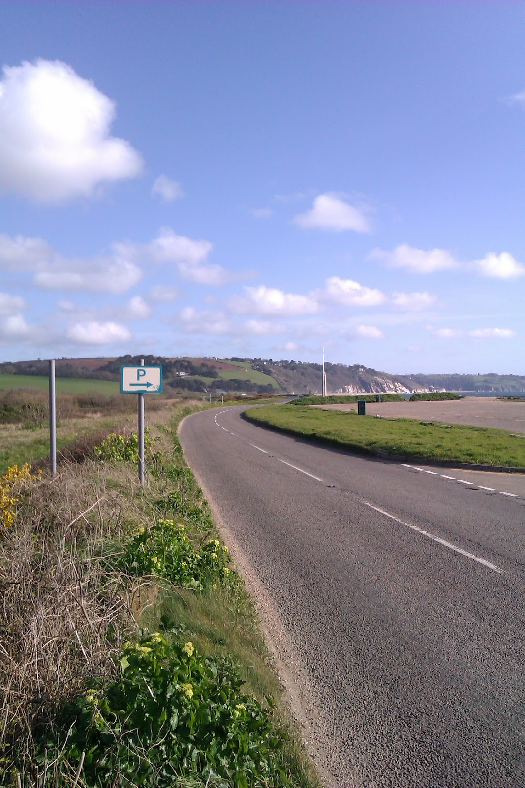
Away I went up the A82 alongside Loch Lochy, Loch Oich and Loch Ness (no monster sightings I'm afraid). Ended up almost at Inverness on the east coast, which is the only alternative to the A890 really. I didn't worry about keeping to the road nearest to the west coast as that involved a lot of faffing and adding a lot more time to the journey than I had planned for with the original route. Traffic was very light and the first stop was at a layby on the A832 heading back west again.

It was then a long long haul around Wester Ross, the scenery that I could see was great. Weather wasn't too bad at this point, a lot of drizzle really, but the cloud hid most the mountains. Made my way round to Ullapool for lunchtime. Bought lunch from Tescos as I didn't want to walk far in the rain and it was next to the car park. Yes, Tesco really are everywhere; passed one in Thurso and picked up petrol at the big store just outside Wick.
Ullapool, or, as the check-in options on
facebook would suggest the locals call it, Loopallu.

Next came the best bit. Further north I went, with my route conveniently signed as the tourist route to John O'Groats. The signs also told me it was 170 miles from Ullapool. After a place called Laxford Bridge the road quality really deteriorated with mile after mile of single-track road with passing places. And sheep providing slalom. Wasn't aware of the sheep issue until I had earlier come over a hill at 50mph and seen one standing in the road in front of me. Between an emergency stop (in the rain) and the sheep seeing me and running away (clearly more intelligent than pheasants) said sheep survived for another day. Saw many more of them in the road after that, but realised that once they noticed you they got out of the way, if not always very quickly. They did seem to like standing on and by the road though as if there wasn't acres upon acres of other places they could have been.

I ended up behind a minibus for the first bit of "single track road", which I was quite happy to do as he was making good progress and could see further down the road than me. Then he decided to let me pass, despite the fact that I had sat well back from him. Felt it was a bit silly to say "no no, you go first and spot the other vehicles for me" so went on ahead. It was ok though; would have helped if more people had had their lights on, especially when it started to get foggy. Having had Radio 2 on most the day (you'll recall I don't have my MP3 charger, and my usual choice of station, Absolute, wasn't being picked up) I lost the signal once I got to the very north. In fact the only 2 stations I could get were Radio 1, and a station playing heavy rock, punk, metal etc. so I went with that.
Some road engineering to appreciate.
The A838 across the Kyle of Tongue.

After what seemed like an eternity, I reached a bit of two lane road again and was heading towards the Kyle of Tongue. After the village of Tongue there was once again a lot of single-track road with passing places (and sheep), but not for quite as long as before. Then, all of a sudden, I was out of the mountains and away, through Thurso, right at John O'Groats and down to Wick.

Traffic was very light all day, partly the weather, partly just because there really aren't that many people living in this part of Britain to create traffic. Took about 7 and a half hours, about an hour quicker than predicted. Starting the long drive home tomorrow :)

Friday, 6 April 2012

The Actual Trip: Day 7

Hello from Fort William! Can't believe I'm over half way through my journey now. Had a really good day today, though the weather could have been better. For the first time I can report that the journey was shorter than expected today, only took 6 hours rather than 6 and a half. Roads were very quite in places though, but lots of holiday traffic on the main routes.

Dumbarton. There were signs up suggesting the place
 I had parked flooded at high tide. Thankfully it wasn't high tide.
Started the day by heading north out of Ayr. The route involved a lot of faffing on and off the A78 through places like Irvine and Androssan. The highlight of this bit of the journey was probably the sign for Bogside. Stopped just after Largs to take some photos looking across to Bute, weather was still a bit iffy. Round through Gourock and Greenock it was somewhat obvious there's an election on from all the SNP signs attached to the lamposts. Next up was the Erskine Bridge, not the easiest to get to without using a motorway. It's pretty huge though, so not hard to miss and certainly isn't one for those afraid of heights.

First break of the day was at Dumbarton, which was very nice. I seemed to making depressingly slow progress by this point; not sure what I was worrying about really though. It was then on up through Helensburgh and passed HMNB Clyde, the home of the UK's nuclear deterrent. Needless to say, it had some very unfriendly looking fencing around it and I thought it best not to stop and ask where they keep the nuclear wessels. Alongside Loch Long and the road quality really deteriorated. I commented the other day on how impressed I was with some of the road engineering in Wales. Well, the A814 alongside Loch Long wasn't so much engineered as someone just laid some tarmac on top of whatever was there before. It was like a mad rollercoaster, even at 35mph. And the loch lived up to it's name.


Lochgilphead. Weather here was typical of most the day.
Eventually I turned onto the A83 and Cicelia's suspension let out a sigh of relief. The route headed away from shore through Argyll Forest Park and over the mountains. The views would have been epic, but it was poring with rain and the hills were all hiding behind the clouds. It was then a long run down Loch Fyne with the weather gradually improving. Spent a lot of time behind a couple of horse boxes before finding a suitable place to pass them. Stopped at Lochgilphead for lunch.

Best bit of the day by far was just after lunch. The 2 cars ahead of me as I headed off up the A816 both turned off fairly soon and then I had the whole road to myself pretty much from there to Oban. 35 miles of unadulterated road and spectacular scenery. Was great. There was a lot more traffic in Oban itself. Not sure where it all suddenly appeared from and it all promptly disappeared again as I left Oban on the A85. Made me wonder if a bunch of people were just driving round the one-way system for the hell of it really. Again the road was very quiet, especially when I crossed the bridge at Connel onto the A828. Was another good drive up to the A82. Pulled onto the A82 behind a queue of traffic that was behind a caravanette and 2 caravans. Oh well, all good things and all that. Trundled into Fort William about half 3.

Across the Loch at Fort William
Weather has really cheered up now, hope it stays that way for tomorrow. It's the bit I've most been looking forward too: round the top of Scotland!

Thursday, 5 April 2012

The Actual Trip: Day 6

Hello from Ayr! That was a long drive today, 350 miles. Took an hour longer than Bing had told me too, ie 9 instead of 8. Can't really see a reason for that, there wasn't loads of traffic though it was a little slow through some of the towns. Hey ho, much shorter day tomorrow.

The sea at Bardsea.
Morecambe seems a long time ago now, yet it was only this morning! Left early knowing it was going to be a long day anyway. Picked up my day's supply of petrol in Carnforth and off I went for a tour round the lake district. Joined the rush hour traffic on the A590 towards Ulverston and Barrow but things were moving quite swiftly. Stopped to take some photos at Bardsea, where there was a sign warning of quick sand, so I didn't head onto the beach! Was going to stop for my first break in Millom (hmm, think I found some of that extra hour, that was two hours to not get that far...) but all the parking was "discs only". To be honest, if you are going to make the parking for your town/village be the sort where you either have to already have a disc, or traipse into a shop looking for one you may as well put up a large sign saying "Visitors Not Welcome Here". So I drove on and stopped in a layby near a place called Bootle.
The Lake District, where I saw no lakes, but lots of mountains.

Weirdly I went through the more well known Bootle yesterday, and there was also another Crosby just up the road. On I went through Whitehaven (actually, that took a while too) and up to Workington. The temporary bridge that was put up after the old bridge was destroyed by the floods in 2009 is still the one being used though construction on the more permanent replacement is well under way.

I went into Carlisle for lunch and found a nice cafe that managed to not have my first 3 choices from their menu available. Had bangers and mash. Into Scotland and away I was on the A75 towards Dumfries. My first impression of driving in Scotland was how darn fast everyone goes! Now, don't get me wrong, I don't pootle and will drive at the speed limit wherever safe to do so, yet I think I have been overtaken on single-carriageway roads more times since entering Scotland than on the rest of the trip so far. Now, at this point the signs were displaying Stranraer as being cheerfully close. Of course, it was if you were sensible and staying on the A75. I was however heading there via the Solway coast. A nice quiet drive it was and it still looked at this point as if Ayr wasn't that far away. Stopped somewhere on the A710 for a break and some photos.
The A710. Traffic level in this photo
was representative of the whole road.

Back on the A75 and I had turned over the page of my map to recall the route was taking me on a long detour down "The Machars". It was a nice drive; it took well over an hour. Finally back on to the A75 I made it to Stranraer, only for a sign to cheerfully tell me it was 50 miles to Ayr, and I was taking the scenic route via the coast. Got there in the end though! Picked up petrol before tomorrow as I was actually starting to get a bit short and it saved doing it in the morning. This was the longest drive so far and it was only 30 miles shorter than my longest drive which is on Easter Sunday. Still seemed shorted than day 2 though, was certainly easier. I did take one wrong turn today, missed a left in Kirkcudbright (which isn't pronounced Kirk cud bright) but other than that was ok. My last night in a Travelodge until Sunday; I have hotels booked as Fort William or Wick don't have Travelodges...

Wednesday, 4 April 2012

The Actual Trip: Day 5

Hello from sunny Morecambe! Today's journey ended up being about many things. Sleet was one of them, so was the wind, as were 3 diversions due to closed roads. There I was thinking it was going to be about the tunnels, though they were pretty good. I again managed to avoid getting lost despite all of that; starting to get the hang of this I think.

I started out just after 8 and the weather was bad, to put it mildly. Bearing in mind that Holyhead sits on an island sticking out into the Irish Sea things aren't going to be great to start off with really. First stop was Tesco to get petrol followed by the trip back to Anglesey, with the A55 being just as bad as the A5 was yesterday. I started to notice lots of lorries parked in laybys and the radio travel news stating that the Britannia Bridge was closed to high-sided vehicles explained that one. The travel news also mentioned that the A55 was closed to everyone between junctions 22 and 23 due to a ship grounding on the rocks at Colwyn Bay and the rescue services needing to use the A55, which is right by the sea there. It was going to be a little while until I got there, so I was hoping maybe it would be re-opened by then.
This picture of Llandudno doesn't quite do justice to the weather.

Off I went round the bottom bit of Anglesey (recall I was doing Anglesey "backwards") and the weather was awful. There was much sleet and it was very gusty. The only positive was that visibility wasn't too bad. Now the views across the Menai Strait are stunning; this morning there was sleet blowing horizontally along it. The Menai Bridge itself was actually ok, as was getting through Bangor. Things were starting to calm down a bit as I headed back onto the A55 with snow visible on the mountains.

Three tunnels later and I was heading towards Llandudno. Weather was getting worse again, so of course I stopped on the seafront to take some pictures of it. Back on the A55 and it wasn't long before I was at the back of the queue for the road closure. To get from junctions 20 to 23 (about 4 miles) took at least an hour, going via the A547 through Old Colwyn for the last bit as that was where the road was closed. Eventually I got to Rhyl and stopped for a break. The rain stopped as well. Went into Costa coffee for a well deserved chocolate muffin.
Rhyl. I had my face sand-blasted getting off the bridge I was standing
 on taking this photo.

With the weather brightening I headed along the edge of the River Dee before crossing it at Connah's Quay. Somewhere just after that I crossed back into England, but missed it entirely. The border happens to also be about where the junction for the A494, A550 and A548 is, and it's quite a large affair, so was making sure I was in the correct lane instead.

Diversion number 2 came on the A540, part of which was closed for resurfacing, so it was the B5135 that I took there, through Neston. Through Hoylake and onto Wallasey the traffic was starting to get quite slow. Not entirely sure I followed the route exactly through Wallasey, but managed to get to the Kingsway tunnel nonetheless, mainly by following the signs for it! Best tunnel of the four. It was then down to the docks, back up from them again and through Crosby. I then stopped for lunch in Formby, which sadly lacked a banjo shop.

Through Southport and on to Preston, where diversion number 3 took place due to the building of a storm drain. The sun now shining it was then onto Lytham St Anne's and the very long, slow and garish drive along Blackpool seafront. A brief highlight was driving through the sand dunes just before Blackpool. In places this was quite literal where the sand had blown onto the road. I would have stopped to take some photos on Blackpool seafront, but £1.50 to park for a few photos wasn't happening. On to Fleetwood and things finally picked up a bit. Well, a little bit. Next it was the A588 to Lancaster, a road which, despite being across really flat countryside seemed to have absolutely loads of corners.
Statue of Eric Morecambe in Morecambe.

Reached Lancaster at the height of rush hour (yay) and crawled round the one-way system before heading to Heysham and then finally Morecambe. The day's journey took about an hour longer than expected, which isn't surprising considering the traffic jam on the A55. Best weather of the day was here so I had a wander down to the seafront and took some photos. I'd go so far to say that it is the nicest town I've stayed in so far, not that the others were particularly bad. Scotland tomorrow.

Tuesday, 3 April 2012

The Actual Trip: Day 4

Hello from Holyhead where the weather is the very definition of "Wet and Windy". A good day today where I didn't get lost once, despite driving through a city. Well, ok, it was a very small city where all I had to do was turn right, but St David's is still a city!
Newgale. Was blowingagale.
The day started with the weather looking quite bright. I'd filled up on my Travelodge "Breakfast Bag", which was tastier than I had expected. First up was the surprise toll bridge on the A470 just north of Pembroke, all of 75p and then through Haverfordwest onto what was a great drive to St David's and up to Fishguard. I took a few photos at Newgale and the beach looked tempting until I got out the car and realised how windy it was. I'd left quite early this morning (well, half 8) and can conclude that rush-hour is a very calm affair in rural Wales.

After Fishguard (more photos) the long drive up the A487 continued. The weather clouded over somewhat and by the time I stopped at Aberaeron it was starting to look quite miserable. On to and through Aberystwth I'm sure the views would have been impressive if not shrouded in cloud. Next up was Machynlleth where my route hugged the coast of the Snowdonia National Park. By the time I got to Aberdyfi and stopped for lunch it was bucketing it down.
Fishguard. Pretty.

I think I managed to miss the worst of the rain by having lunch. The drive itself was quite fun, even in the wet and the traffic was very light most the way. I couldn't help but admire the short walls alongside either side of the road (and later on the A496), not for the fact that I didn't want to get my car anywhere near them, but that at one point in time someone (or more likely someones) had spent a lot of time and effort building them. along with making the road fairly decent.

The rain easing off a bit I headed round through Barmouth and Harlech and could admire the mountains a bit more now. It was then on to Porthmadog and what seemed a very long drive to Pwllheli where I had another stop. It was then up the wide and straight A499 (completely different to the narrow winding A399) for the final leg to Holyhead. Through Caernarfon where there were huge queues going in the other direction it was then a quick hop onto the A55 to get across the Britannia Bridge. Annoying I didn't get the chance to admire the bridge too much as the traffic was quite heavy and I was heading off at the next junction. Or so I thought, then I remembered at the last moment that I needed junction 8, not 8a, which was about 100 yards later.

At this point, with over 6 hours driving behind me I thought "ah, just a quick trip round Anglesey then to  Holyhead". Was nearly another hour, not helped by a couple of really dawdly people. I did manage to overtake one of them but I don't have the greatest confidence for pulling off safe overtakes on roads I don't know. The other one eventually turned off. Nearly took a wrong turn when I finally got to the A5 where Holyhead was signposted in the opposite direction to what I was expecting and, again at the last moment, I realised that this was because the signs wanted me to use the A55, which I didn't.
Pwllheli. Difficult to pronounce.

The bridge across to Holy Island was very very windy and the steering wheel was gripped very firmly! And then there I was, Holyhead, heading over the railway line to the Travelodge. All in all it took about 7 hours, again a bit longer than expected. Today's excuse will be the 3 times I had to sit at roadworks where convoys were operating, particularly outside Aberystwyth where it took a good 20 minutes to get through. Along one of my favourite roads tomorrow, The A55 North Wales Expressway and then back to England, where hopefully it won't be raining quite so much.

Monday, 2 April 2012

The Actual Trip: Day 3

Hello from Pembroke Dock! What a day... As predicted when I wrote the post about the Day 3 route, there was quite a bit of getting lost. Survived though and found my way. Took just over 7 hours, which was somewhat longer than I thought it would, but it doesn't help when I drive around in circles.

Started with overpriced breakfast in the cafe at the service station that I had stayed the night above. Not really enough staff working there either so it was a bit of a wait. Some guy in the queue ended up commenting "I blame the government"; think he was confused between petrol queues and breakfast queues. Anyway, on the topic of petrol I picked up at the service station, which was a mistake as of course I paid a lot more than I needed to. I've spotted a nice Tesco petrol station just up the road for tomorrow.

So off I went up the A38, heading towards Weston-Super-Mare. The first bit of getting lost was soon to follow when the road I wanted to take was closed for roadworks and the diversion just sent me round in a circle. Found my way back out the town in the end though by following (M5) signs. Both the M5 and M4 were going to mock me for most the day for my refusal to use them. Along to Bristol when I got to admire the Clifton Suspension Bridge from below; it's a B-road so not on the route. Sadly nowhere to stop nearby so no photos. The gorge it spans is impressive too.
The Second Severn Crossing. 

Back under the M5 and through the docks and industrial estates at Avonmouth I went. Feeling short-changed about not being able to photograph one suspension bridge I turned off for a stop at Severn Beach and got to photograph two. The views were magnificent and it was quite fun to look back down the coast at the places I'd been yesterday and look across the estuary at the places I was going for today. I hopped back in the car, drove over the M4 and did my sole bit of motorway on my journey crossing the Severn using the M48 (£6!). It's a fairly diddy motorway, having been the old M4 before the new one was built further south and I managed to use all the M48's numbered junctions, those being junction 1 and junction 2!
The First Severn Crossing

Onto the A48 now, which was to become today's A39. I was pleased to have avoided driving up or down any significant hills at this point and there weren't really any hills of note until Barry, which was a relief after yesterday. Having crossed the M4 again it was round the south of Newport, meeting the M4 again on the other side and heading to Cardiff. Came off the A48 a junction too early so drove round the roundabout and back onto the A48 again. Took the correct junction and came to the day's main traffic jam.

Now, I had ended up on the A4161 as planned, and according to my directions I needed to go left at some traffic lights onto the A4160 to Penarth. I missed this turning somehow (the signs were there I think, I had been checking on streetview when I wrote those directions) and ended up in the city centre, not really sure where I was going. Thankfully I had a lot of time sitting at traffic lights to look at my map, and while I could have just taken a direct route towards the next town on my route (Barry) I would have missed out on both the tunnel and the large bridge at Cardiff Bay. So a couple of left turns and a bit of guessing later I managed to find the A4160 and was back on my way.

Next up was Barry, which joined Bethany and Mark as "places I had seen that shared their names with people". This one should have been simple. I followed the A4055 into the town and then the signs for the A4055 disappeared, so I thought "through traffic" would be a good bet to follow. This ridiculously sent me round in a circle, so I followed "Barry Island" instead and managed to find the one-way system and the A4050 that my directions mentioned. Found my way back to the A48 and had lunch in Cowbridge.
The Physic Garden at Cowbridge.

After lunch, a wander around Cowbridge and a really good check of the rest of the day's directions, I set off towards Bridgend. This bit was fine, down to Porthcawl and up again, yep ok, back across the M4 at J37: check. More A48. Across the M4 again at J38, Port Talbot, and it was here that the M4 really seemed determined that I should use it. For the unaware, the M4 goes pretty much through the middle of Port Talbot, so that's the easiest way to go. So much so that at one point had the driver in front of me not dived off the onslip at J41 at the last moment to take the A48 instead, allowing me to follow, I would have ended up on the M4. No big disaster had I done, but it would have been annoying. Oh, and for added fun at this point the A48 crossed the offslip for said junction, as in you need to stop and give way to traffic that is charging off the motorway and you can't really see up onto the motorway.

That bit of fun over I went under the M4 for the last time (which was really really high up here) to head towards Swansea. Swansea wasn't very eventful but took forever thank to loads and loads and loads of traffic lights. There were then some more traffic lights, and for good measure, temporary traffic lights replacing normal traffic lights. Eventually I was heading towards Llanelli and after that it was back to country-lane driving, around the wonderfully named Kidwelly and up to the A40 at Carmarthen. Things were pretty straightforward then, in and out of Tenby, where I would have stopped had it not been raining. One last traffic jam in Pembroke thanks to that perennial scourge known as Gas Main Works and eventually I got to Pembroke Dock.

Not as long a drive as yesterday and thankfully no large city/town driving tomorrow at all. I have just noticed though that there appears to be a toll on my map for tomorrow that I hadn't noticed before...

Sunday, 1 April 2012

The Actual Trip: Day 2

Hello from Bridgwater! Gosh is was a long way to get here, but I survived. I knew this was going to be a long day, and it was. Unlike yesterday there wasn't much to see once I got to my destination, so I wasn't so bothered by it . Took about 9 hours, which was a little longer than Bing had said, but a number of wrong turns, correcting them and various dawdly people in front of me made things longer.
Sunny Torquay!

The weather was much better today, was sunny all day, if not so warm. Headed out of Torquay and despite having an ok amouny of petrol I filled up almost straight away as the Shell garage just along the road was selling it cheap. Well, cheap compared to everywhere else. Took a wrong turn quite early on in my attempts to avoid using the Dartmouth ferry but nothing too difficult to sort out. Was a lovely drive from Totnes down to Dartmouth and very twisty from there to Kingsbridge, but some fantastic scenery. I stopped at the beach at Slapton to take photos as it was very lovely.

Through Plymouth was ok, the Tamar bridge had some good views. I made my first rest stop at Saltash services which were very dull. On towards Liskeard making rapid progress as the A38 is a pretty good road. Was lots of following holiday traffic all the way down to Helston, and got a bit lost when the route had me turning off the A390 to go through Par but again a u-turn sorted things. Had lunch at Helston and took a wander around. Had been planning to get to Penzance for lunchtime, but I was hungry. It was then up the A30, with lots of roadsigns for places I'd already been, before heading through Newquay to the A39.

The A379 at Slapton.
Oh, the A39. Most the rest of the day was on the A39, titled "The Atlantic Highway", must have been getting on for 3 hours of it. Started off as quite a good road, though was stuck behind a milk tanker that annoying I had passed earlier on the A30, but thanks to it not going via Newquay it had gone back passed me. Was going to stop at Bude, but the route didn't really get into the town, so stopped in Kilkhampton instead. Not the most exciting of places but it had a shop, somewhere to park and a public toilet which was all I needed! More A39, through Bideford (another great bridge) to Barnstaple.

From Barnstaple it was off the A39 for a bit to get to Ilfracombe. Really dull road into Ilfracombe, made duller by lots of reduced speed limits for little-to-no reason, though got quite good at the town itself. Got thoroughly lost in Ilfracombe. Could have sworn the main road went along the seafront; apparently not. Eventually found the A399 climbing steeply out of Ilfracombe. the A399 set the scene for the return to the A39 with it's narrow steep twisty route. The road straightened out eventually somewhere up on Exmoor before heading into the Watersmeet gorge.

At this point sensible traffic takes the B-road straight down to Lynton and Lynmouth. The A39 however heads through the gorge, barely two lanes wide in most places, with a number of hairpins and lots of blind corners with rock face on one side and a sheer drop the other. Thankfully I was following someone , so they had the job of watching for oncoming traffic! Out of the gorge it was down into Lynmouth before a 1 in 4 climb back up again. Cecilia did a good job with this bit, made lots of noise (as she had done with a hairpin earlier that need 1st gear) but got up the hill. I think they should sell T-shirts that say "I survived Watersmeet Gorge and Porlock Hill".
Helston Boating Lake, the location of lunchtime.

Things calmed down a bit again as I headed towards Porlock. Porlock is of course infamous for it's hill, and the signs as you head towards it warn you of this. It reminded me a bit of being on a log flume waiting for the big drop, though when I did finally get there I was behind someone with a "P" plate on who was understandably taking things very carefully. Lots of hairpins on the way down as well. Eventually the road settled down again and it was a long trundle to Minehead and eventually Bridgwater, where I again got lots finding the Travelodge despite it being at a junction with the M5.

Really enjoyed it again though, the bit from Dartmouth to Plymouth and the A39 from Ilfracombe to Minehead were my favourite bits. A very different day from yesterday with much less town driving. A much shorter day tomorrow (200 miles compared to 320), but lots of cities and towns to get lost in!